
San Leandro Neighbors By Block
A block lookup combines map geometry with narrow record routes. GIS shows the parcel pattern and public assessment fields. The Recorder names parties to a selected instrument. Qualified voter data may support a permitted analysis, but the self-service voter tool is personal. Permits and 311 events show address activity. Neighborhood Watch and local groups provide civic contact, not membership evidence.
The coverage table is a map of what a neighbor search can legitimately show. A source that names a parcel or project should not be stretched into a list of everyone connected to the block.
| Source | What It Shows About A Block | Access |
|---|---|---|
| Alameda GIS | Adjacent polygons, APNs, situs and mailing, values, exemptions, latest instrument | Free map and parcel popups |
| Recorder | Named parties and recorded title events for each selected parcel | Party index; copies cost |
| Qualified voter file | Statutorily available registration fields for an approved purpose | Application and restrictions |
| Permits and CityDash | Address projects, permits, inspections, 311 or civic events | Public fields vary; requests available |
| Neighborhood Watch | Safety discussion and organizing contact | Police partner channel; no roster |
| Community groups | Public organizations and contact routes | Contact information only |
| Historical directories | Past listed occupants in street sequence | Library use; gaps and omissions |
The block view becomes reliable when each parcel is saved with its own source date and record purpose.
Click San Leandro Neighbor Parcels
The Alameda GIS viewer does not need a prebuilt neighbor list. Search the starting address or APN, zoom to the selected polygon, close or read its popup, and click an adjacent polygon. Repeat the process around the block face. The map supplies parcel geometry, not a household roster. A selected parcel may be split, joined, commercial, vacant, or associated with a mailing address away from the site.
The viewer provides Zoom, Home, My Location, Overview, Measurement, Bookmark, Basemap Gallery, Layer List, About, and attribute-table tools. Measurement can show distance or area. Layer controls can change visibility, transparency, labels, order, popups, and details or downloads. These controls help describe the block's shape and development without implying a person is present.
- Verify the starting address and open its APN and composed situs fields.
- Click each adjacent polygon and record APN, situs, mailing, values, exemption, and latest instrument fields.
- Use the Recorder for the selected instrument and match party names to the legal description.
- Add a permit, 311, or historical directory clue only when its address and date fit the same parcel.
- Stop at the record boundary. Do not infer private household members from the map.
The Alameda parcel feature layer is the map doorway for a San Leandro neighbors search.
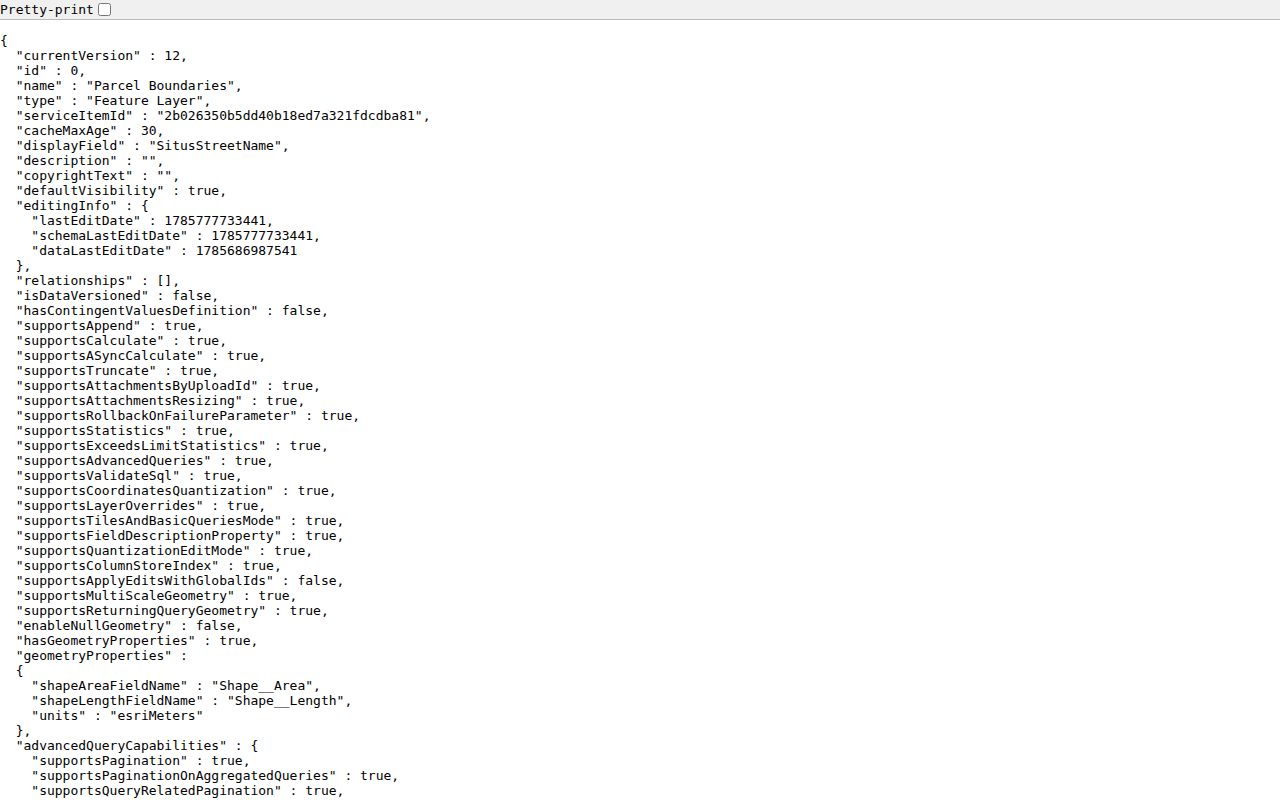
The feature-layer capture reinforces the parcel-by-parcel method and the public fields available at each click.
San Leandro Neighbor GIS Fields
The inspected San Leandro parcel result exposed APN and parsed book, page, parcel, and subparcel data; centroid; tax-rate areas; situs number, street, unit, city, ZIP, and ZIP+4; land and improvement assessed values; CLCA values; homeowners exemption; other exemption; total net value; latest document prefix, series, and date; mailing street, unit, city, state, and ZIP; use code; economic unit; composed situs; composed mailing; and geometry area or length.
No owner-name or sketch field exists in the public feature layer. If the map identifies a parcel but not an owner, save the APN and move to the Recorder's party index or counter. Repeating the address search will not uncover a suppressed name. A tax mailing address may suggest organizational or absentee ownership, but it never proves who lives at the site.
- APN
- Assessor's parcel number, the stable key used to connect the map to related records.
- Situs
- The physical location of the parcel.
- Mailing
- The address used for assessment correspondence, which may differ from situs.
- HOEX
- Homeowners exemption, a possible principal-residence clue that is not conclusive.
San Leandro Neighbor Radius Limits
San Leandro's configured GIS viewer has no radius or buffer button that returns a named neighbor list. The practical block tools are map browse, direct polygon click, zoom, measurement, and attribute table. A buffer can describe distance, but it does not establish a group of residents or bypass voter and privacy rules.
Use a clear boundary instead: adjacent polygons, one block face, a named street segment, or a measured distance used only for mapping. Record why each parcel was included. If the goal is a whole street, the San Leandro street directory owns the longer address chain. If the goal is a historical block, Haines and city directories supply dated listings.
The absence of a radius tool is a useful guardrail. It keeps a neighbor lookup tied to visible parcels and a stated research purpose instead of producing a vague people list.
San Leandro Neighbor Deed Searches
Each neighboring parcel can become its own Recorder inquiry. Use the latest document prefix, series, date, APN, or book/page clue from GIS. Inspect the instrument for grantor, grantee, legal description, title form, signatures, and recording information. Match the legal description before joining a named party to the block.
Alameda's electronic party index reaches from 1969 to the present. Records from 1853 through 1968 use microfilm at 1106 Madison Street in Oakland. Index research is free; plain and certified copies carry the published per-page fees. The office says printing stops at 4:15 and recording at 4:30, with noon to 2 p.m. busiest.
A neighbor search can therefore be a series of small deed trails. One parcel may show a trust, another an individual, and another an organizational mailing address. Those are title clues, not a complete block census.
San Leandro Neighbor Voter Data
California My Voter Status confirms a person's own registration, polling place, districts, materials, and ballot status. It does not browse names on a San Leandro block. A voter-file application can request a statewide, county, or limited specific-voter file only for a permitted election, political, scholarly, journalistic, governmental, or record-review purpose.
The application requires applicant contact and identity details, scope, intended use, security recipients, wet signature, and payment. The published fee is $15 per 1,000 records with a $100 statewide maximum, or $30 per specific record up to ten and $100. Elections Code section 18109 makes knowing misuse for a nonpermitted purpose a misdemeanor. Safe at Home and other protected addresses remain withheld.
A “no result” from the self-service form is not a clearance of a block. It means the tool is doing what it was designed to do.
San Leandro Neighbor Permit Clues
San Leandro Accela and CityDash add event evidence around a parcel. The permit guide says the Property Address flow starts with the street number, then Search lets the GIS populate known streets. A guided record can attach an associated parcel and owner, applicant, licensed professional, attachments, permit number, inspection actions, and statuses such as Submitted, In Review, Plan Review, Ready for Inspection, and Issued.
CityDash and open-data links can show Mobile 311 requests, police calls for service, permits, agreements, ordinances, and meetings. Public fields vary, and the city warns that CityDash is unavailable on mobile browsers. A permit or 311 event tells a block researcher that an address had a project or civic contact. It does not identify every person present or imply a private fact.
For a missing historical file, request an existing address-based series through San Leandro's public-records route. State the address, record type, and date range rather than asking the city to create a resident list.
San Leandro Neighbor Watch Contact
San Leandro Neighborhood Watch is an organizing channel, not a directory. The Police Department can attend a residence, agreed meeting place, or police facility to discuss trends, safety, reporting, and neighbor interaction. The Crime Prevention Unit can be reached at 510-577-3228. The online form asks for first name, last name, email, comments, CAPTCHA, and submission.
The city Neighborhood Watch page and its contact form provide a way to organize a conversation. They do not publish a group list, member addresses, or a block roster. A neighbor lookup should link the civic route without implying membership.
Crime Prevention Unit
Neighborhood Watch organizing and safety discussion
510-577-3228
San Leandro Neighbor Community Groups
The city's network page names several community contacts that can help a person understand local civic structure. Public contact information does not prove that a resident belongs to a group, lives in its service area, or supports its work. Treat the names as conversation routes and neighborhood-history leads.
| Named Resource | Public Role | What It Does Not Provide |
|---|---|---|
| Mulford Gardens Improvement Association | Neighborhood improvement contact | No public member or household roster |
| Bethel Presbyterian Community Church | Community and congregation contact | No public list of attendees or members |
| Church of Christ and Lewis Avenue Neighbors | Named local network resource | No inference about an individual's address or membership |
| San Leandro Improvement Association / Downtown Community Benefit District | Downtown civic and business network; board named by role | Not a general resident directory |
The San Leandro network-sites page is the source for the named contacts. A current comprehensive association or HOA inventory was not verified.
San Leandro Neighbor Tools Compared
Commercial neighbor tools compile inputs and may charge, merge same-name people, lag corrections, or create a broad radius impression. Official rolls are narrower but show the custodian, field, date, and access rule. Use a commercial compilation only as an unverified lead and return to the source record.
| Need | Official path | Compilation limit |
|---|---|---|
| Adjacent land | GIS polygon and APN sequence | A radius label may not match parcels or city limits |
| Recorded party | Recorder instrument and legal description | A merged name may omit the document that controls |
| Block project | Permit, 311, or focused city record request | An event does not equal a household or resident list |
| Community contact | Neighborhood Watch or named public organization | A profile cannot prove membership or attendance |
This distinction makes the neighbor lookup more useful. It tells the reader which parcel, agency, or community source can answer the next question.
What San Leandro Neighbors Cannot Show
A public block map does not list every household member, private association member, utility customer, delivery customer, or protected voter. DMV data is restricted. Safe at Home substitutes a protected mailing address. Voter access follows purpose rules. Recorded documents may redact sensitive identifiers, while ordinary title information remains in the land record. These gaps are part of the lawful boundary of a neighbors search.
California stalking law, Civil Code section 1708.7, Penal Code section 646.9, and voter misuse rule section 18109 matter when an address trail is used against a person. The Safe at Home governing-law page explains the protected-address program, while the California Privacy Protection Agency's broker page describes Delete Act requirements. The purpose should be defined before the first parcel is clicked. Personal safety, genealogy, civic curiosity, and block history are different from compiling a target list.
When the target expands from one block to a whole named street, use the address chain in the San Leandro street directory. When the question turns historical, use the city directory and previous-resident trails.